English
Opportunità per svolgere un dottorato di ricerca internazionale tra Italia e Miami (Florida)
Perugia/Miami, 22 aprile 2022. Il centro di ricerca WARREDOC è tra i promotori del programma di scambio accademico internazionale per l’ottenimento del doppio titolo di dottore di ricerca in Italia e negli Stati Uniti. Il Doppio Titolo (Dual PhD Degree) è rilasciato dal Department of Earth and Environment della...

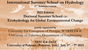
Il Dipartimento di Ingegneria dell’Università di Palermo ospiterà il 10-14 luglio la 2022 INTERNATIONAL SUMMER SCHOOL ON EXTREMES IN WATER SCIENCE
Il Centro WARREDOC Center e l’Università di Palermo sono i co-organizzatori della “2022 International Summer School on Extremes in Water Science” che si terrà a Palermo presso il Dipartimento di Ingegneria dal 10 al 14 luglio 2022. Le iscrizioni sono ora aperte. Chi è interessato può visitare pagina web...
The 2020 International Summer School on “Extremes in Water Science” è stata RINVIATA a luglio 2022
La International Winter School “Extremes in Water Science”, considerata l’evoluzione della pandemia COVID, è stata rinviata alla settimana 11-15 luglio 2022 per consentire di svolgere l’evento in presenza. Per maggiori informazioni, vi invitiamo a visitare la pagina web dell’evento che è stato conseguentemente ridenominato Summer School “Extremes in Water...